
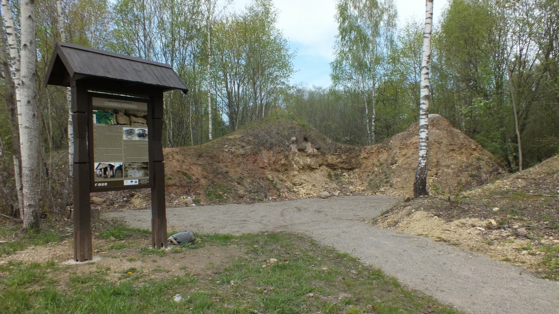
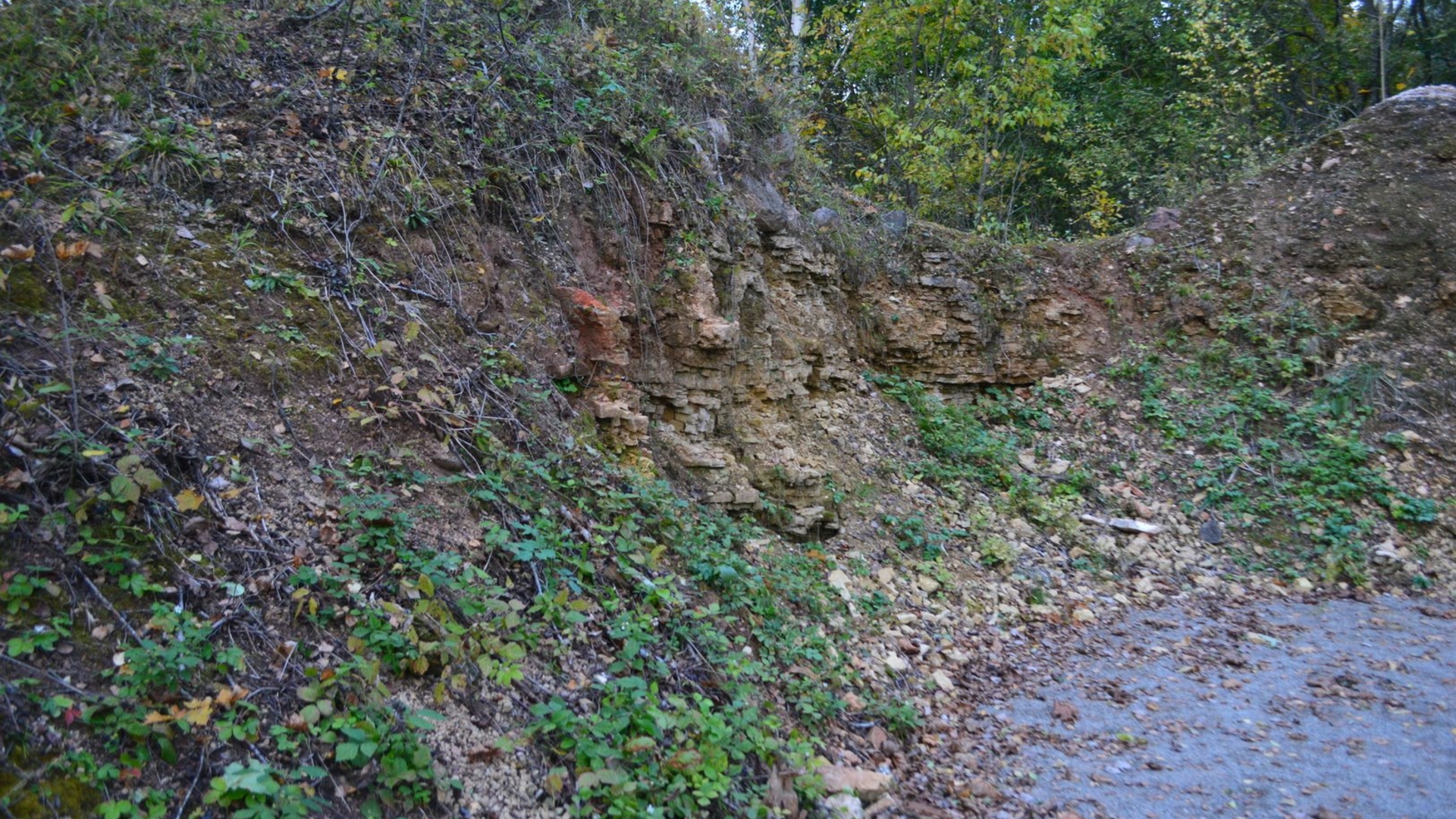
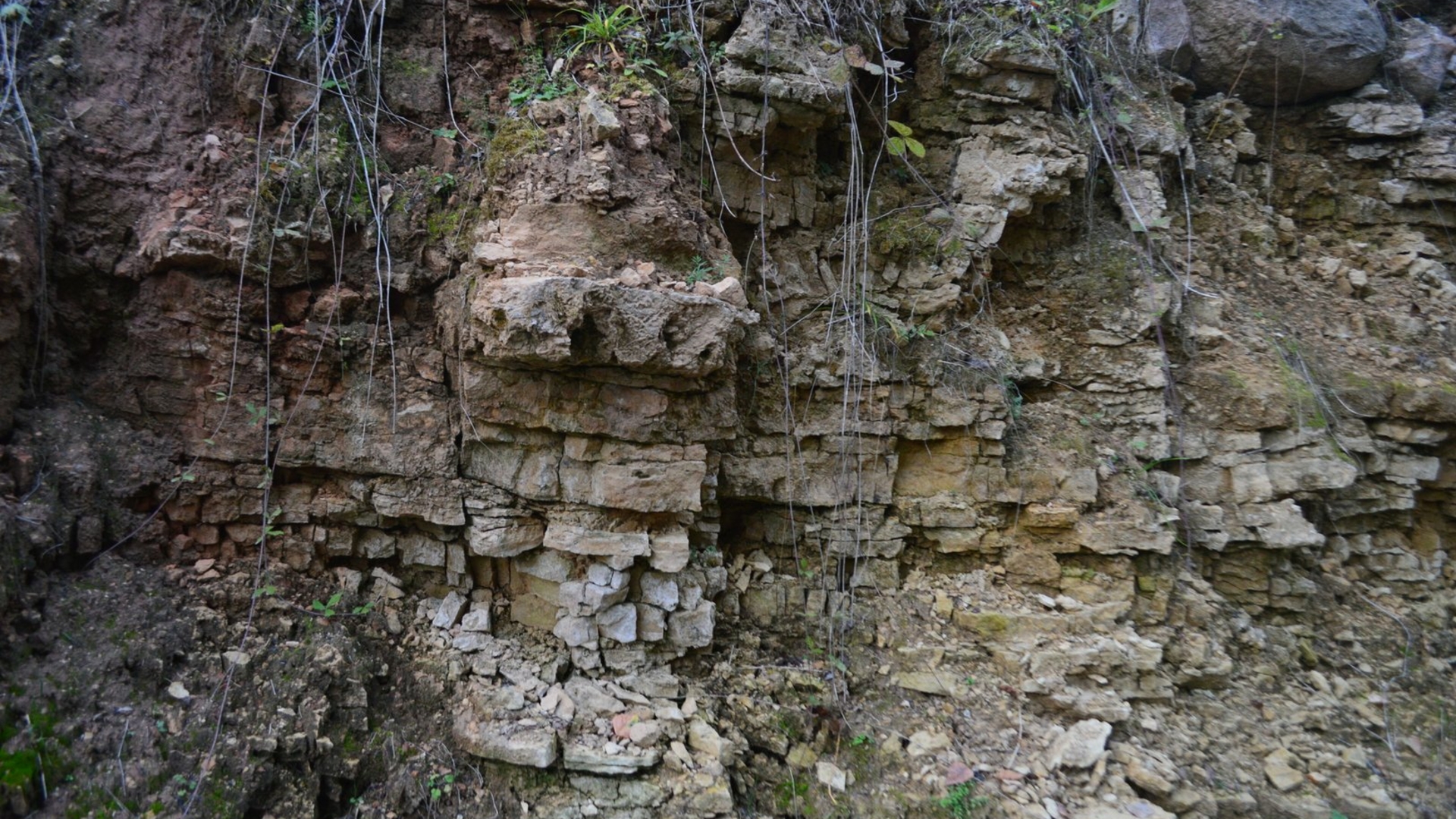
The Stirniškiai Outcrop is located in the Lėvuo Landscape Reserve, in Stirniškiai village, near the confluence of the Lėvuo and Suosa rivers. Layered dolomite can be seen in the 40-meter-long outcrop. The outcrop was declared a geological natural monument in 1964. This geological natural monument consists of the rock outcrops in the curved 3-4 meter high walls of the abandoned Stirniškiai quarry, where dolomite was mined. About 40,000 cubic meters of dolomite were manually mined in the Stirniškiai quarry for the production of lime from 1953 to 1964. Lime was of good quality and in high demand. Next to the outcrop, there are the remains of the Palėvenė (Komarai) Manor farmhouse (kluonas) with a portico of four dolomite columns. This manor building is overgrown with bushes and is in a state of emergency – there is a warning sign about this. The Stirniškiai outcrop is also called by other names: the Stirniškiai quarry wall, the Paulianka dolomite outcrop and the dolomite building, the Paulianka dolomite outcrop.
+3

Reviews